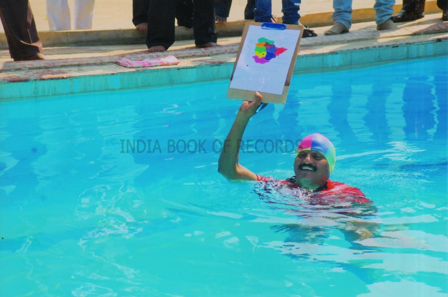
Ch. Kumaraswamy (born on May 26, 1963) of Warangal, Andhra Pradesh, drew the outline of Telanganna (a part of Andhra Pradesh) while floating on water, within 11 minutes and 1 second, on December 17, 2012. He made the drawing on A4 size sheet with a pencil and used a pen for writing the names of 10 districts. This map measures 12 cm vertically and 13.3 cm horizontally.